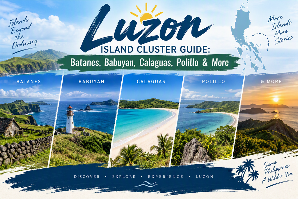
Explore the Luzon Island Cluster including Batanes, Babuyan Islands, Calaguas, Polillo, Hundred Islands, Caramoan, and Romblon. Learn about geography, culture, biodiversity, and travel opportunities.
Luzon Island Cluster Guide: Northern Frontier Islands, Hidden Archipelagos & Coastal Escapes of Luzon
Discover the diverse island clusters surrounding Luzon, from the windswept landscapes of Batanes in the far north to the island-studded waters of Pangasinan and the Bicol Region. This guide focuses primarily on geography, nature, culture, and regional significance while highlighting travel opportunities for visitors seeking some of the Philippines’ most remarkable island destinations.
Affiliate Disclosure
This article may contain affiliate links. If you book accommodations, transportation, tours, or travel services through our recommended partners, we may earn a commission at no additional cost to you.
What Is the Luzon Island Cluster?
The Luzon Island Cluster refers to the many island groups, archipelagos, and offshore island provinces surrounding Luzon, the largest island in the Philippines. While Luzon itself serves as the country’s political, economic, and cultural center, the waters surrounding it contain dozens of significant island clusters that contribute to the nation’s biodiversity, maritime heritage, tourism industry, and regional identity.
These islands range from remote volcanic outposts near Taiwan to tropical island-hopping destinations in the Bicol Region and forest-covered islands off the coast of Quezon Province.
Major Island Clusters Covered in This Guide
- Batanes Islands
- Babuyan Islands
- Calaguas Islands
- Polillo Islands
- Hundred Islands
- Caramoan Islands
- Romblon Islands
Quick Facts Table
| Cluster | Province/Region | Known For |
| Batanes | Batanes | Ivatan culture, cliffs |
| Babuyan | Cagayan | Volcanoes, wilderness |
| Calaguas | Camarines Norte | White-sand beaches |
| Polillo | Quezon | Biodiversity, forests |
| Hundred Islands | Pangasinan | Island hopping |
| Caramoan | Camarines Sur | Limestone islands |
| Romblon | Romblon | Marble, diving |
Batanes Islands
Overview
The Batanes Islands represent the northernmost province of the Philippines and consist of a small archipelago situated between Luzon and Taiwan. The province is renowned for its dramatic landscapes, rolling green hills, rugged cliffs, stone houses, and the unique culture of the Ivatan people.
Unlike many tropical destinations in the country, Batanes offers scenery often compared to parts of Ireland, New Zealand, and Scotland due to its open grasslands and windswept coastline.
Geographic Significance
- Northernmost province of the Philippines
- Located in the Luzon Strait
- Important maritime and weather observation region
- Strategic location between the Philippine Sea and South China Sea
Natural Highlights
- Basco Lighthouse
- Marlboro Country Hills
- Valugan Boulder Beach
- Sabtang Island
- Morong Beach
- Mount Iraya
Cultural Importance
The islands are home to the Ivatan people, whose traditional stone houses were specifically designed to withstand powerful typhoons and harsh weather conditions. The preservation of Ivatan architecture and traditions makes Batanes one of the country’s most culturally distinctive destinations.
Visiting Batanes
Batanes is best suited for travelers interested in:
- Culture and heritage
- Photography
- Nature exploration
- Slow travel experiences
- Scenic road trips
Book Your Batanes Adventure
Recommended:
- Flights to Basco
- Guided Batanes cultural tours
- Heritage accommodations
- Island-hopping excursions to Sabtang and Itbayat
Related Guides
- Batanes Island Cluster
Babuyan Islands
Overview
The Babuyan Islands form a remote volcanic archipelago situated between mainland Luzon and Taiwan. Although often overshadowed by nearby Batanes, the Babuyan Islands represent one of the most untouched island groups in the Philippines.
The cluster includes several islands featuring active volcanoes, steep coastlines, rich marine ecosystems, and low population densities.
Main Islands
- Babuyan Island
- Camiguin Norte
- Calayan Island
- Dalupiri Island
- Fuga Island
Geographic Features
The region is characterized by:
- Active volcanic systems
- Rocky coastlines
- Mountainous terrain
- Isolated beaches
- Rich marine biodiversity
Ecological Importance
The islands support:
- Endemic bird species
- Marine mammals
- Coral reef systems
- Migratory bird populations
Because of their isolation, the Babuyan Islands remain among the least-developed island regions in the country.
Tourism Potential
Tourism remains limited, making the islands ideal for:
- Expedition travelers
- Adventure tourism
- Wildlife enthusiasts
- Volcano explorers
- Remote island experiences
Related Guides
- Babuyan Island Cluster
Calaguas Islands
Overview
Located in Camarines Norte Province, the Calaguas Islands have become one of Luzon’s best-known beach destinations. Despite increasing popularity, the island group still retains much of its natural beauty and laid-back character.
The islands are particularly famous for their long stretches of white sand and clear blue waters.
Key Islands
- Tinaga Island
- Guintinua Island
- Maculabo Island
- Several smaller offshore islets
Natural Attractions
Mahabang Buhangin Beach
The most famous attraction in Calaguas features:
- Powdery white sand
- Crystal-clear water
- Minimal development
- Excellent swimming conditions
Environmental Value
The islands support coastal ecosystems including:
- Coral reefs
- Seagrass beds
- Marine fish habitats
- Coastal bird populations
Why Visitors Love Calaguas
Travelers visit for:
- Beach camping
- Snorkeling
- Swimming
- Island photography
- Off-grid experiences
Accommodation Recommendation
Visitors can choose from:
- Beach campsites
- Guesthouses
- Island cottages
- Eco-friendly accommodations
Related Guides
- Calaguas Island Cluster
Polillo Islands
Overview
Located off the eastern coast of Quezon Province, the Polillo Islands comprise a large island group known for forests, waterfalls, rich biodiversity, fishing communities, and traditional island lifestyles.
Unlike many of the country’s better-known tourism destinations, Polillo remains largely unexplored by international visitors.
Main Islands
- Polillo Island
- Patnanungan Island
- Jomalig Island
- Panukulan Island
- Burdeos Island
Geographic Importance
The islands serve as an ecological transition zone between Luzon and the Philippine Sea.
The region contains:
- Tropical forests
- Mangrove systems
- River systems
- Coastal wetlands
- Marine habitats
Biodiversity
The Polillo Islands are recognized as an important conservation landscape due to their populations of:
- Endemic birds
- Forest wildlife
- Native plants
- Coral reef ecosystems
Local Communities
Most residents depend on:
- Fishing
- Agriculture
- Coconut farming
- Small-scale commerce
Traditional island culture remains an important part of daily life.
Notable Attractions
Jomalig Island
Known for:
- Golden-colored beaches
- Remote coastal landscapes
- Crystal-clear waters
- Island camping opportunities
Waterfalls and Forest Areas
Visitors can explore:
- Interior forests
- Hiking trails
- River systems
- Local villages
Tourism Opportunities
Polillo appeals to travelers seeking:
- Ecotourism
- Wildlife observation
- Beach exploration
- Off-the-beaten-path adventures
Where to Stay
Accommodation options include:
- Local guesthouses
- Beachfront cottages
- Family-run lodges
- Community-based homestays
Plan Your Visit
Before traveling, compare:
- Ferry schedules
- Island accommodations
- Guided nature tours
- Local transport options
Booking accommodations in advance is strongly recommended due to limited room availability.
Related Guides
- Polillo Island Cluster
Hundred Islands
Overview
The Hundred Islands National Park is one of the most recognizable natural attractions in the Philippines. Located in Lingayen Gulf near Alaminos City, Pangasinan, the protected area consists of more than one hundred limestone islands and islets scattered across shallow coastal waters.
Geological Significance
The islands formed through:
- Uplifted coral reefs
- Limestone erosion
- Marine geological processes
Over thousands of years, these processes created the unique island landscape visible today.
Popular Islands
Governor’s Island
Known for:
- Scenic viewing decks
- Panoramic photographs
- Elevated viewpoints
Quezon Island
Popular for:
- Swimming
- Family recreation
- Beach activities
Children’s Island
Designed for:
- Family-friendly tourism
- Safe swimming areas
- Day-trip visitors
Outdoor Activities
Visitors enjoy:
- Island hopping
- Kayaking
- Snorkeling
- Swimming
- Cliff viewing
- Camping
Conservation Importance
The national park protects:
- Marine habitats
- Coral reefs
- Coastal ecosystems
- Native wildlife
Related Guides
- Hundred Islands Cluster
Caramoan Islands
Overview
The Caramoan Islands in Camarines Sur have gained international recognition for their spectacular limestone formations, hidden beaches, and pristine island environments.
The region’s dramatic landscapes have attracted filmmakers and adventure travelers from around the world.
Geographic Features
The cluster includes:
- Limestone cliffs
- Sea caves
- Hidden lagoons
- Isolated beaches
- Coastal forests
Major Attractions
Matukad Island
Known for:
- White sand beaches
- Limestone scenery
- Emerald waters
Lahos Island
Famous for:
- Unique sandbars
- Photogenic landscapes
- Island hopping excursions
Cotivas Island
Attracts visitors seeking:
- Tranquility
- Crystal-clear water
- Snorkeling opportunities
Tourism Significance
Caramoan is considered one of Luzon’s premier island-hopping destinations and appeals to:
- Beach lovers
- Adventure travelers
- Photographers
- Nature enthusiasts
Related Guides
- Caramoan Island Cluster
Romblon Islands
Overview
Although administratively part of the MIMAROPA Region, the Romblon Islands sit strategically between Luzon and the Visayas and are often included among central Philippine island clusters due to their geographic position and maritime connections.
The province consists of several major islands and numerous smaller islands spread across the Sibuyan Sea.
Principal Islands
Romblon Island
Known for:
- Provincial capital
- Historic sites
- Marble industry
Tablas Island
The largest island in the province and home to:
- Mountain landscapes
- Beaches
- Waterfalls
- Coastal communities
Sibuyan Island
Often called the “Galápagos of Asia” because of its extraordinary biodiversity.
Natural Highlights
Mount Guiting-Guiting
One of the country’s most challenging and respected mountain peaks.
Cresta de Gallo
A spectacular sandbar destination featuring:
- White sand
- Turquoise waters
- Remote island scenery
Economic Importance
Romblon is internationally known for:
- High-quality marble production
- Fishing industries
- Agriculture
- Growing ecotourism opportunities
Tourism Appeal
Visitors come for:
- Diving
- Island hopping
- Hiking
- Wildlife observation
- Beach exploration
Related Guides
- Romblon Island Cluster
Comparing Luzon’s Island Clusters
| Island Cluster | Best Known For |
|---|---|
| Batanes | Ivatan culture, dramatic landscapes |
| Babuyan | Volcanoes and wilderness |
| Calaguas | White-sand beaches and camping |
| Polillo | Biodiversity and ecotourism |
| Hundred Islands | Island hopping and recreation |
| Caramoan | Limestone formations and hidden beaches |
| Romblon | Marble, diving, mountains, beaches |
Why These Island Clusters Matter
Together, these island groups showcase the extraordinary geographic diversity of the Luzon region. From the windswept hills of Batanes and volcanic Babuyan Islands to the tourism hotspots of Caramoan and Hundred Islands, each cluster contributes to the cultural heritage, environmental significance, and tourism appeal of the Philippine archipelago.
For travelers, they offer a range of experiences from expedition-style adventures and ecotourism to beach vacations and island-hopping excursions. For researchers and geography enthusiasts, they highlight the complex island systems that make the Philippines one of the world’s largest archipelagic nations.
Related Guides
Learn About Luzon
- Luzon Island Facts & Statistics
- History of Luzon Island
- Regions and Provinces of Luzon
- Major Islands of the Luzon Island Group
- Geography of Northern Luzon
Visit Luzon
- Luzon Island Travel Guide
- Best Beaches in Luzon
- Best Islands to Visit in the Philippines
- Batanes Travel Guide
- Caramoan Travel Guide
- Romblon Travel Guide
- Hundred Islands National Park Guide
- Calaguas Island Travel Guide
Booking Resources
- Compare Flights to Luzon Destinations
- Search Hotels and Resorts
- Book Island-Hopping Tours
- Travel Insurance for the Philippines
- eSIM and Mobile Data Options for Travelers