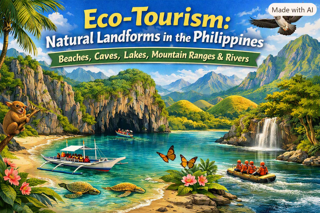
Explore the Philippines’ diverse natural landforms including waterfalls, beaches, volcanoes, lakes, rivers, wetlands, and caves. Includes top destinations, travel tips, and detailed guides for nature travelers.
- Note; Due to the size of this Topic it had to be broken into to two (2) Landing pages.
Natural Landforms in the Philippines Part 1 – Complete Travel Guide
Natural Landforms in the Philippines Part 2 – Complete Travel Guide
The Philippines is one of the world’s most geographically diverse nations, shaped by tectonic activity, tropical climate, and centuries of natural evolution. This guide covers every major landform category, with detailed insights and top destinations.
Overview of Philippine Natural Landforms
- Over 7,641 islands
- Part of the Pacific Ring of Fire
- Home to UNESCO natural wonders
- Rich biodiversity across marine, freshwater, and forest ecosystems
Landform Categories
- Beaches
- Caves
- Lakes & Rivers
- Mountain Ranges
Other Landforms Categories: See Natural Landforms in the Philippines Part 2
- Sandbars & Sandbar Islands
- Volcanoes
- Waterfalls
- Wetlands
Stay Updated
We regularly add new informational posts to help travelers discover more of the Philippines. Check back often for fresh guides, tips, and insights.
Philippine Beaches Guide | Best White Sand, Pink Sand & Hidden Shores
Explore the Philippines’ top beaches including Boracay, Palawan, Siargao, and hidden island gems. Ideal for swimming, diving, surfing, and island hopping.
Beaches in the Philippines – Full Guide
The Philippines is globally recognized for its pristine beaches, ranging from powdery white sands to volcanic black shores.
Top Beaches
- White Beach (Boracay)
- Nacpan Beach (Palawan)
- Pink Beach (Zamboanga)
- Dahican Beach (Davao Oriental)
- Alegria Beach (Siargao)
Best Time to Visit
Dry season (Nov–May) for calm seas and clear skies.
Travel Tips
- Use reef-safe sunscreen
- Avoid stepping on corals
- Check tide schedules
- Support local tourism
Related Guides
- Top Beaches in the Luzon Island Group Guide
- Top Beaches in the Visayas Island Group Guide
- Top Beaches in the Mindanao Island Group Guide
- Top 15 Beach Destinations in the Philippines
Caves in the Philippines | Underground Rivers & Limestone Formations
Explore the Philippines’ caves including Puerto Princesa Underground River, Callao Cave, and Sumaguing Cave. Ideal for spelunking and nature tours.
Caves in the Philippines – Full Guide
The Philippines’ caves feature limestone formations, underground rivers, and archaeological sites.
Top Caves
- Puerto Princesa Underground River (Palawan)
- Callao Cave (Cagayan)
- Sumaguing Cave (Sagada)
- Hinagdanan Cave (Bohol)
Best Time to Visit
Dry season for safer cave access and clearer pathways.
Travel Tips
- Wear helmets and headlamps
- Follow guide instructions
- Avoid touching formations
Related Guides
- Top Caves, Cave Systems & Natural Tunnels in the Luzon Island Group Guide
- Top Caves, Cave Systems & Natural Tunnels in the Visayas Island Group Guide
- Top Caves, Cave Systems & Natural Tunnels in the Mindanao Island Group Guide
Philippine Lakes & Rivers | Freshwater Wonders & Travel Guide
Discover the Philippines’ most beautiful lakes and rivers including Lake Sebu, Kayangan Lake, Loboc River, and Cagayan River.
Lakes & Rivers in the Philippines – Full Guide
Freshwater ecosystems offer boating, rafting, fishing, and nature exploration.
Top Lakes
- Lake Sebu (South Cotabato)
- Kayangan Lake (Coron)
- Lake Pinatubo (Zambales)
Top Rivers
- Loboc River (Bohol)
- Cagayan River (Luzon)
- Hinatuan Enchanted River (Surigao del Sur)
Best Time to Visit
Dry season for clearer waters and safer river activities.
Travel Tips
- Wear life vests
- Avoid swimming in deep river sections
- Support local boat operators
Mountain Ranges in the Philippines | Cordillera, Sierra Madre & More
Explore the major mountain ranges of the Philippines, including the Cordillera Central, Sierra Madre, and Zambales Mountains. Learn how to get there, nearby towns to stay in, and top hiking destinations across Luzon and Mindanao.
1. Cordillera Central Mountains | Highest Range in Luzon, Towns & Travel Guide
Discover the Cordillera Central—Luzon’s highest mountain range. Includes Mount Pulag, Sagada, Banaue, and Baguio. Learn how to get there, best towns to stay in, and top hiking spots.
The largest and highest mountain system in the Philippines, home to Mount Pulag and the UNESCO Rice Terraces.
How to Get There
- From Manila to Baguio (Gateway City):
- Bus via NLEX/Kennon or Marcos Highway (PHP 450–800).
- From Baguio to Mountain Towns:
- Jeepney/van routes to Sagada, Bontoc, Banaue, Kabayan (Pulag).
- From Manila to Banaue (Rice Terraces):
- Direct night bus (Ohayami/Coda Lines), 8–9 hours, PHP 750–1,200.
Local Towns for Stays
- Baguio — regional hub, hotels, transport access.
- Sagada — cool-weather mountain town known for caves, hanging coffins, pine forests.
- Bontoc — central access point to Mountain Province.
- Banaue — gateway to UNESCO rice terraces.
- Kabayan — closest town to Mount Pulag’s Ambangeg trail.
2. Sierra Madre Mountains | Longest Range in the Philippines, Towns & Travel Guide
Meta Description
Explore the Sierra Madre—the Philippines’ longest mountain range. Learn access routes, nearby towns, and top eco‑tourism and hiking destinations.
The longest mountain range in the Philippines, running along Luzon’s Pacific coast.
How to Get There
- From Manila to Rizal/Quezon Sierra Madre Foothills:
- Private car or van via Marcos Highway or Manila East Road.
- Northern Sierra Madre (Isabela/Cagayan):
- Flights to Tuguegarao or Cauayan, then land travel to foothill towns.
Local Towns for Stays
- Tanay, Rizal — gateway to Sierra Madre viewpoints and waterfalls.
- General Nakar & Infanta (Quezon) — coastal access to forest reserves.
- Ilagan & Cauayan (Isabela) — access to Northern Sierra Madre Natural Park.
3. Zambales Mountains | Mount Pinatubo, Hiking Routes & Travel Guide
Meta Description
Discover the Zambales Mountains—home of Mount Pinatubo’s crater lake. Includes access routes, nearby towns, and best hiking seasons.
A volcanic mountain chain along western Luzon, home to Mount Pinatubo.
How to Get There
- Mount Pinatubo Access (Capas, Tarlac):
- Drive or bus from Manila to Capas (2–3 hours).
- Transfer to 4×4 jeep to the jump-off point.
- Alternate Access (Botolan, Zambales):
- Coastal route via Subic or Olongapo.
Local Towns for Stays
- Capas, Tarlac — main jump-off for Pinatubo treks.
- Botolan & Iba (Zambales) — coastal towns near mountain foothills.
- Subic Bay — full-service hotels and transport access.
4. Caraballo Mountains | Luzon Highlands, Access Routes & Towns.
Explore the Caraballo Mountains—linking the Cordillera and Sierra Madre. Learn how to get there and nearby towns for stays. A connecting range between the Cordillera Central and Sierra Madre.
How to Get There
- From Manila to Nueva Vizcaya:
- Bus to Bayombong/Solano (7–8 hours).
- From Cagayan Valley:
- Land travel from Tuguegarao or Santiago City.
Local Towns for Stays
- Bayombong & Solano (Nueva Vizcaya) — main access towns.
- Dupax & Kasibu — closer to Caraballo foothills.
5. Kitanglad Mountain Range | Mount Dulang‑dulang, Access & Towns.
Meta Description
Discover the Kitanglad Range in Bukidnon—home to Mount Dulang‑dulang and Mount Kitanglad. Includes access routes and nearby towns. Home to Mount Dulang‑dulang and Mount Kitanglad, among the highest peaks in the Philippines.
How to Get There
- Fly to Cagayan de Oro or Davao, then travel to Bukidnon.
- Malaybalay City is the main gateway to Kitanglad trails.
Local Towns for Stays
- Malaybalay City — closest major city to trailheads.
- Valencia City — alternative base with more lodging options.
6. Kalatungan Mountain Range | Mount Kalatungan Travel Guide
Meta Description
Explore the Kalatungan Range—one of Mindanao’s highest mountain systems. Learn how to get there and nearby towns for stays. A rugged high-altitude range near Kitanglad, home to Mount Kalatungan.
How to Get There
- Fly to Cagayan de Oro, then travel to Bukidnon.
- Access via Pangantucan or Maramag municipalities.
Local Towns for Stays
- Pangantucan — closest to Kalatungan trailheads.
- Valencia City — larger town with hotels and transport.
7. Diwata Mountain Range | Eastern Mindanao Highlands Guide
Discover the Diwata Mountains—stretching across eastern Mindanao. Includes access routes and nearby towns. A long mountain chain along eastern Mindanao.
How to Get There
- Fly to Butuan or Davao, then travel to Agusan del Sur or Surigao del Sur.
- Access via national highways along the eastern corridor.
Local Towns for Stays
- Butuan City — northern gateway.
- San Francisco (Agusan del Sur) — central access point.
- Bislig — coastal town near southern Diwata foothills.
Final Thoughts
The Philippines is one of the most geographically diverse countries on Earth, and this Complete Guide to Natural Landforms brings together every major attraction—beaches, caves, lakes, mountain ranges, rivers, sandbars, volcanoes, waterfalls, and wetlands—into one unified resource. With over 7,641 islands, the country’s landscapes are shaped by tectonic forces, tropical climate, and centuries of natural evolution, resulting in destinations that are both visually stunning and culturally meaningful.
For travelers, researchers, and tourism planners, understanding these landforms isn’t just about sightseeing. It’s about appreciating how each feature supports biodiversity, local livelihoods, and sustainable tourism. Whether you’re exploring sandbars like Kalanggaman, trekking mountain ranges like the Cordilleras, diving into caves in Palawan, or marveling at volcanoes like Mayon, the Philippines offers endless opportunities for discovery.