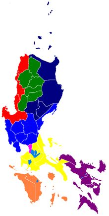
Map of the Luzon Island Group by en.academic.com
Luzon Island Group – Complete Administrative & Travel Guide
The Luzon Island Group is the largest and most populous island group in the Philippines. It serves as the country’s political, economic, and historical core, containing many of its largest cities, major transportation hubs, and most significant cultural landmarks. Luzon encompasses a diverse landscape that ranges from the mountain ranges of the Cordillera Region and the rice terraces of Northern Luzon to the beaches of Batangas, the islands of MIMAROPA, and the volcanic landscapes of the Bicol Peninsula.
Although geographically located within the Luzon Island Group, the National Capital Region (NCR) functions as a separate administrative region and does not belong to any provincial government. NCR serves as the political, economic, and cultural center of the Philippines while remaining geographically part of the broader Luzon Island Group.
Quick Facts About the Luzon Island Group
| Feature | Information |
|---|---|
| Island Group | Luzon |
| Location | Northern Philippines |
| Administrative Regions | NCR, CAR, Region I, Region II, Region III, CALABARZON, MIMAROPA, Bicol Region |
| Number of Regions | 8 |
| Number of Provinces | 39 |
| Largest City | Quezon City |
| Capital City | Manila |
| Major Islands | Luzon, Mindoro, Palawan, Marinduque, Catanduanes, Romblon Islands, Polillo Islands |
| Known For | History, culture, beaches, volcanoes, mountains, government and commerce |
| Major Airport Gateway | Ninoy Aquino International Airport (NAIA) |
| Major Seaports | Manila Port, Batangas Port, Subic Port |
| Famous Destinations | Baguio, Vigan, Batanes, Palawan, Puerto Galera, Mayon Volcano, Hundred Islands |
| Major Mountain Ranges | Cordillera Central, Sierra Madre, Zambales Mountains |
| Famous Volcanoes | Mayon, Taal, Pinatubo, Bulusan |
| Best For | History, food, road trips, beaches, mountains, culture, eco-tourism |
| Geographic Role | Northern administrative, economic, and cultural core of the Philippines |
Administrative Identity of the Luzon Island Group
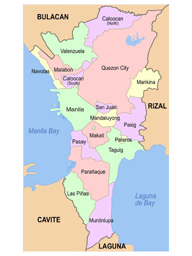
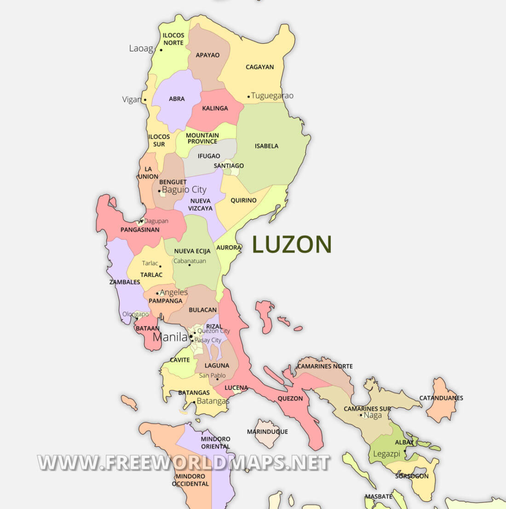
NCR by scribd.com Luzon Mainland by freeworldmaps.net MIMAROPA by guidebookbali.com
Luzon forms the administrative heart of the Philippines and contains the country’s largest concentration of population, economic activity, government institutions, transportation infrastructure, and major urban centers. The island group encompasses mainland provinces, island provinces, metropolitan centers, agricultural regions, mountain provinces, and some of the Philippines’ most significant cultural and historical destinations.
Administrative Regions of the Luzon Island Group
The Luzon Island Group contains eight administrative regions, making it the most administratively diverse island group in the Philippines. These regions range from the mountainous highlands of the Cordillera region and the agricultural plains of Central Luzon to the island provinces of MIMAROPA and the volcanic landscapes of the Bicol Peninsula.
Although geographically part of Luzon, the National Capital Region (NCR) functions as a separate administrative region and does not belong to any provincial government. NCR serves as the political, economic, and cultural center of the Philippines while remaining geographically located within the Luzon Island Group.
Luzon Administrative Regions
| Region | Description |
|---|---|
| National Capital Region (NCR) | The political, economic, and cultural center of the Philippines. Composed of 16 cities and 1 municipality with no provincial governments. |
| Cordillera Administrative Region (CAR) | A mountainous highland region known for indigenous cultures, cool climates, and the world-famous Banaue Rice Terraces. |
| Region I – Ilocos Region | Known for heritage towns, historic architecture, beaches, and strong Ilocano cultural traditions. |
| Region II – Cagayan Valley | A largely agricultural region featuring river valleys, mountains, caves, and the northern island province of Batanes. |
| Region III – Central Luzon | The country’s primary agricultural region and home to major historical sites, industrial centers, and growing urban areas. |
| Region IV-A – CALABARZON | One of the Philippines’ most economically developed regions, combining industry, heritage sites, mountains, lakes, and coastal destinations. |
| Region IV-B – MIMAROPA | An island region composed of Mindoro, Marinduque, Romblon, and Palawan, known for marine biodiversity and world-renowned island destinations. |
| Region V – Bicol Region | Famous for Mayon Volcano, spicy cuisine, surfing destinations, and strong regional cultural identity. |
Regional Structure of Luzon
The Luzon Island Group combines mainland regions, island regions, metropolitan centers, and mountain provinces, creating the most geographically diverse administrative structure in the Philippines.
- NCR serves as the country’s administrative and economic core.
- CAR occupies the mountainous highlands of Northern Luzon.
- Regions I, II, and III form much of Northern and Central Luzon.
- CALABARZON anchors Southern Luzon.
- MIMAROPA covers many of Luzon’s largest offshore island provinces.
- Bicol Region occupies the southeastern peninsula and serves as Luzon’s gateway to the Visayas.
Together, these eight regions form the administrative framework of the Luzon Island Group and contain many of the Philippines’ largest cities, busiest transportation hubs, most productive agricultural areas, and most visited tourist destinations.
Provinces of Luzon
Luzon contains 39 provinces, the largest concentration of provinces in the Philippines.
NCR
- No provinces
Cordillera Administrative Region (CAR)
- Abra
- Apayao
- Benguet
- Ifugao
- Kalinga
- Mountain Province
Region I – Ilocos Region
- Ilocos Norte
- Ilocos Sur
- La Union
- Pangasinan
Region II – Cagayan Valley
- Batanes
- Cagayan
- Isabela
- Nueva Vizcaya
- Quirino
Region III – Central Luzon
- Aurora
- Bataan
- Bulacan
- Nueva Ecija
- Pampanga
- Tarlac
- Zambales
Region IV-A – CALABARZON
- Batangas
- Cavite
- Laguna
- Quezon
- Rizal
Region IV-B – MIMAROPA
- Marinduque
- Occidental Mindoro
- Oriental Mindoro
- Palawan
- Romblon
Region V – Bicol Region
- Albay
- Camarines Norte
- Camarines Sur
- Catanduanes
- Masbate
- Sorsogon
Major Cities of Luzon
Luzon contains many of the Philippines’ largest and most influential cities.
Key Highly Urbanized Cities
- Manila
- Quezon City
- Makati
- Taguig
- Pasig
- Pasay
- Caloocan
- Baguio
- Angeles City
- Olongapo City
- Antipolo
- Legazpi
- Naga
Other Major Cities
- Vigan
- Laoag
- Tuguegarao
- San Fernando (Pampanga)
- Lucena
- Batangas City
- Puerto Princesa
Geography of the Luzon Island Group
Luzon is the largest island group in the Philippines and features the country’s most varied geography.
Key Geographic Features
- Sierra Madre Mountain Range
- Cordillera Central
- Zambales Mountains
- Cagayan Valley
- Central Luzon Plains
- Bicol Peninsula
- Manila Bay
- Laguna de Bay
Major Volcanoes
- Mayon Volcano
- Taal Volcano
- Mount Pinatubo
- Mount Bulusan
- Mount Banahaw
Significant Islands
- Palawan
- Mindoro
- Marinduque
- Catanduanes
- Polillo Islands
- Lubang Island
Economy of Luzon
Luzon serves as the economic engine of the Philippines and generates the majority of the country’s economic output.
Key Economic Sectors
- Government and Public Administration
- Finance and Banking
- Manufacturing
- Agriculture
- Tourism
- Trade and Logistics
- Information Technology and BPO Services
- Fisheries and Aquaculture
Major Economic Centers
- Metro Manila
- Clark
- Subic
- Batangas
- Calabarzon Industrial Corridor
- Baguio
- Legazpi
Travel Overview of Luzon
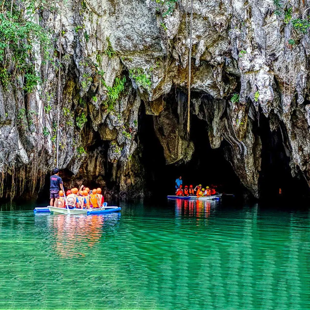
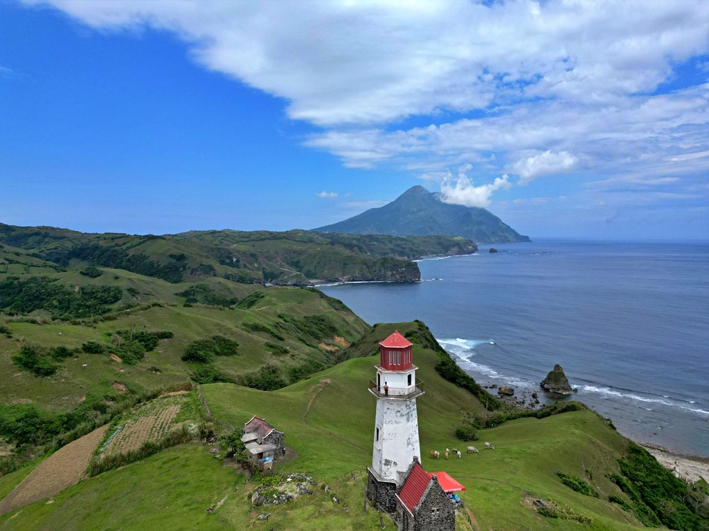
by storage.googleapis.com by appadociaconcepttour.com
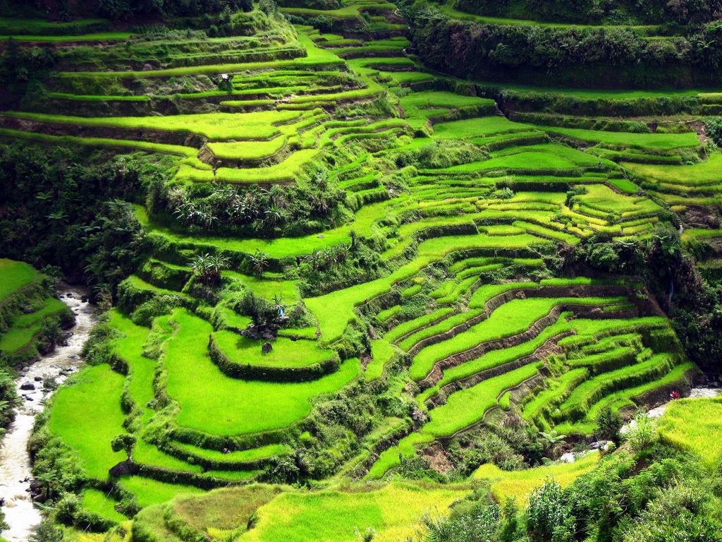
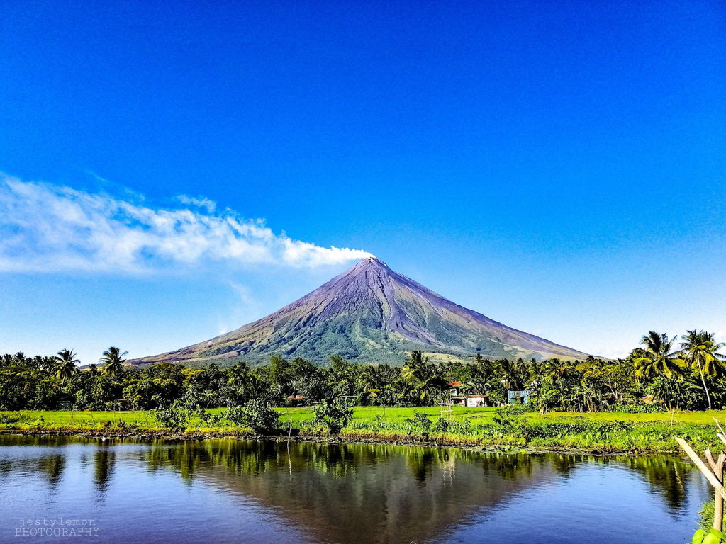
by ar.inspiredpencil.com by wallpapereaccess.com
Luzon offers the widest variety of travel experiences in the Philippines.
Top Destinations
- Baguio City
- Vigan
- Hundred Islands
- Subic
- Anilao
- Puerto Galera
- Palawan
- El Nido
- Coron
- Mayon Volcano
- Batanes
- Sagada
- Banaue Rice Terraces
- Dingalan
- Baler
- Batangas
Popular Travel Experiences
- Heritage tourism
- Beach vacations
- Food trips
- Road trips
- Mountain adventures
- Volcano exploration
- Island hopping
- Surfing
- Cultural tourism
- Eco-tourism
Travel Gateways
Major entry points into the Luzon Island Group include:
- Ninoy Aquino International Airport (NAIA)
- Clark International Airport (CRK)
- Laoag International Airport
- Bicol International Airport
- Puerto Princesa International Airport
- Tuguegarao Airport
- Manila Port
- Batangas Port
- Subic Port
Related Guides
- Regions of the Philippines
- National Capital Region (NCR)
- Cordillera Administrative Region (CAR)
- Ilocos Region
- Cagayan Valley
- Central Luzon
- CALABARZON
- MIMAROPA
- Bicol Region
- Luzon Provinces Directory
- Major Cities of Luzon
- Philippine Administrative Divisions
- Philippine Statistics
- Luzon Road Trips Guide
- Top Beaches in Luzon
- Luzon Budget Travel
Conclusion
The Luzon Island Group serves as the political, economic, cultural, and historical heart of the Philippines. From the government centers of Metro Manila and the mountain landscapes of the Cordilleras to the island provinces of MIMAROPA and the volcanic scenery of Bicol, Luzon offers unmatched geographic diversity and administrative importance. Whether exploring the region’s provinces, learning about its administrative structure, or planning a Philippine adventure, Luzon provides the foundation for understanding the country’s northern and central regions.