Explore Metro Manila’s 16 major cities in the National Capital Region (NCR). Administrative profiles, travel insights, districts, barangays, and related guides for visitors, expats, and researchers.
NCR – National Capital Region (Metro Manila) Major Cities Hub
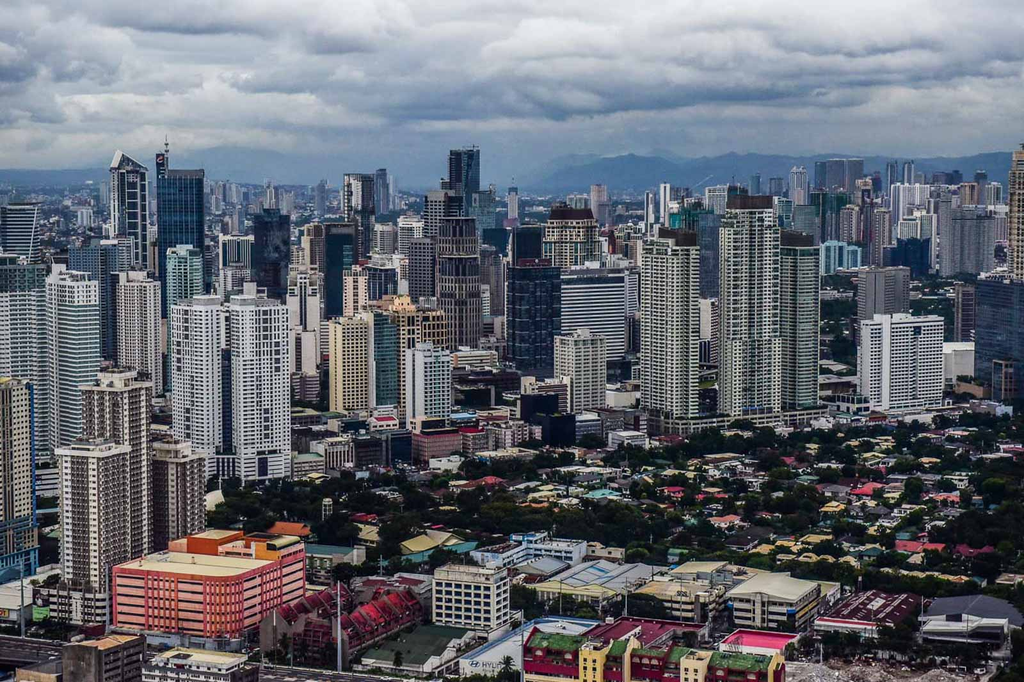
The National Capital Region (NCR)—commonly known as Metro Manila—is the political, economic, cultural, and demographic center of the Philippines. This landing page serves as your Major Cities Hub, providing structured access to all 16 highly urbanized cities and Pateros, the region’s lone municipality.
NCR is the country’s most densely populated region, home to over 13 million residents, and functions as the Philippines’ primary gateway, financial core, and largest metropolitan area.
by ar.inspiredpencil.com
Overview of NCR’s Major Cities
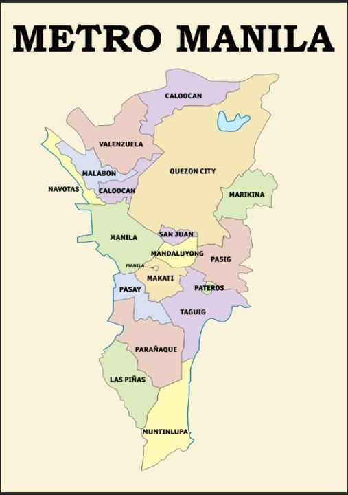
NCR is composed of 16 cities and 1 municipality, each with distinct administrative identities, cultural character, and economic roles. Below is the complete list, each linked to its dedicated city profile page.
Highly Urbanized Cities of NCR
- Manila Travel Page — Capital of the Philippines; historic core
- Quezon City — Largest city by population; government & education hub
- Caloocan — Divided North & South districts; major residential center
- Las Piñas — Known for heritage sites and suburban communities
- Makati — Premier financial district of the Philippines
- Malabon — Coastal city with strong culinary heritage
- Mandaluyong — Shopping & business district; Ortigas Center
- Marikina — Cleanest, most organized city; shoe capital
- Muntinlupa — Southern gateway; home to Alabang CBD
- Navotas — Fishing industry capital
- Parañaque — Entertainment City & coastal communities
- Pasay — NAIA airport, MOA complex, tourism gateway
- Pasig — Ortigas CBD; modern residential districts
- San Juan — Smallest city; historic landmarks
- Taguig — Bonifacio Global City (BGC); modern financial hub
- Valenzuela — Industrial and manufacturing center
Municipality
- Pateros — Only municipality in NCR; known for duck-raising heritage
by lazada.com.ph
Administrative Structure of NCR
NCR is unique among Philippine regions because it has no provinces. Instead, it is organized into:
Administrative Layers
- 16 Highly Urbanized Cities
- 1 Municipality (Pateros)
- 699 Barangays
- 4 Legislative District Groupings
- Metropolitan Manila Development Authority (MMDA)
District Groupings
- Manila — 16 districts
- Quezon City — 6 districts
- Caloocan — North & South
- Makati — 2 districts
- Taguig — 2 districts
These divisions are essential for governance, urban planning, and regional statistics.
Geography & Urban Landscape
Metro Manila spans 619.57 km², located on the western side of Luzon. Its geography shapes its economy, transportation, and population distribution.
Key Geographic Features
- Manila Bay — Western coastline
- Laguna de Bay — Eastern boundary
- Pasig River — Connects Manila Bay to Laguna de Bay
- Marikina Valley — Eastern lowland area
- Coastal zones — Navotas, Malabon, Parañaque, Las Piñas
Urbanization dominates the region, with limited natural forest cover.
Economy & Urban Development
NCR contributes over 30% of the Philippines’ GDP, making it the country’s economic powerhouse.
Major Economic Zones
- Makati CBD — Finance, banking, corporate HQs
- Bonifacio Global City (Taguig) — Tech, startups, modern business district
- Ortigas Center (Pasig/Mandaluyong) — Mixed-use commercial hub
- Manila Port Area — Logistics, shipping, trade
- Valenzuela & Caloocan — Manufacturing & industrial zones
Related Guides
Strengthen your silo with direct links to your other regional and administrative hubs: