Learn how to navigate the Philippines through its airports, seaports, ferry routes, bus systems, rail networks, road classifications, bridges, and expressways. A complete guide for travelers and researchers.
Transportation & Infrastructure in the Philippines
The Philippines’ transportation network is a complex, evolving system shaped by geography, modernization, and archipelagic realities. This pillar page serves as your authoritative reference for all major transport modes — from airports and seaports to roads, bridges, railways, and expressways.
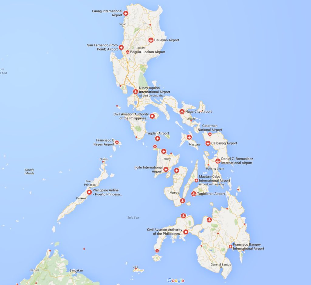
Philippines Airports by planeflighttracker.com
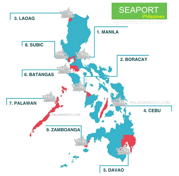
by palawandays.com
Airports — International & Domestic
Air travel is the backbone of long‑distance mobility in the Philippines. With over 80 airports nationwide, the system is divided into international gateways and domestic airports that connect remote islands to major cities.
International Airports
These airports handle global arrivals, OFW routes, and major tourism flows.
- Ninoy Aquino International Airport (NAIA) — Manila’s primary gateway
- Mactan–Cebu International Airport (MCIA) — Visayas’ premier hub
- Clark International Airport (CRK) — Luzon’s expanding alternative
- Davao International Airport (DVO) — Mindanao’s main international link
- Iloilo, Kalibo, Puerto Princesa, Bohol–Panglao — tourism‑driven international routes
Domestic Airports
Domestic airports ensure inter‑island connectivity:
- Bacolod–Silay, Cagayan de Oro (Laguindingan), General Santos, Zamboanga
- Smaller airports like Siargao, Camiguin, Coron (Busuanga), Catarman, Masbate
Airport Infrastructure Improvements
- Runway expansions
- New terminals (Cebu, Clark, Bohol)
- Digitalization of check‑in and immigration
- Ongoing proposals for a New Manila International Airport (Bulacan)
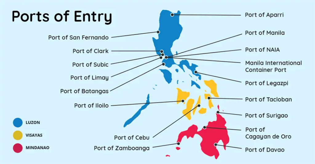
by discoverthephilippines.com
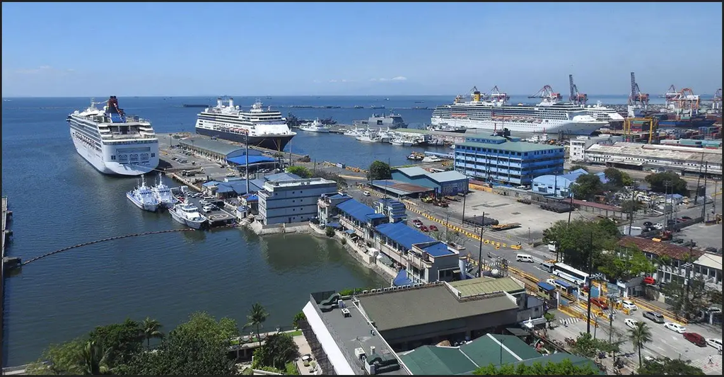
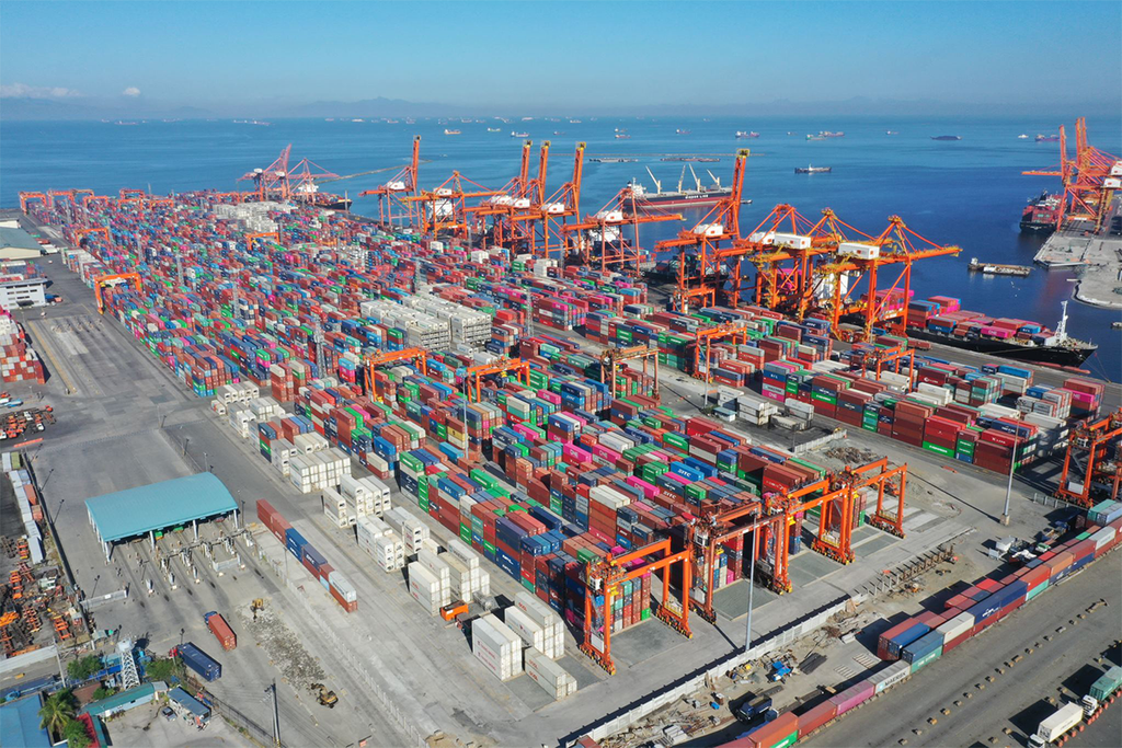
Manila Seaport by discoverthephilippines.com Manila International Container Terminal | MICT by mict.com.ph
Seaports
Seaports are vital for trade, logistics, and inter‑island travel. The Philippines has over 400 ports, categorized into major commercial ports and passenger terminals.
Major Commercial Ports
- Port of Manila — largest cargo volume
- Batangas Port — CALABARZON industrial gateway
- Subic Bay Freeport — logistics and transshipment
- Cebu International Port — Visayas’ main cargo hub
- Davao & General Santos Ports — Mindanao’s export centers
Passenger Seaports
- Cebu Pier 1–3 — busiest passenger port
- Manila North Harbor — Luzon’s main passenger terminal
- Iloilo, Bacolod, Cagayan de Oro, Zamboanga — regional hubs
by ouiphilippines.com
by globe.com.ph
Philippine Roro Ferry by dutchpickle.com
Ferry Networks
The ferry system is essential for travel across the archipelago. It includes:
RORO (Roll‑On Roll‑Off) Routes
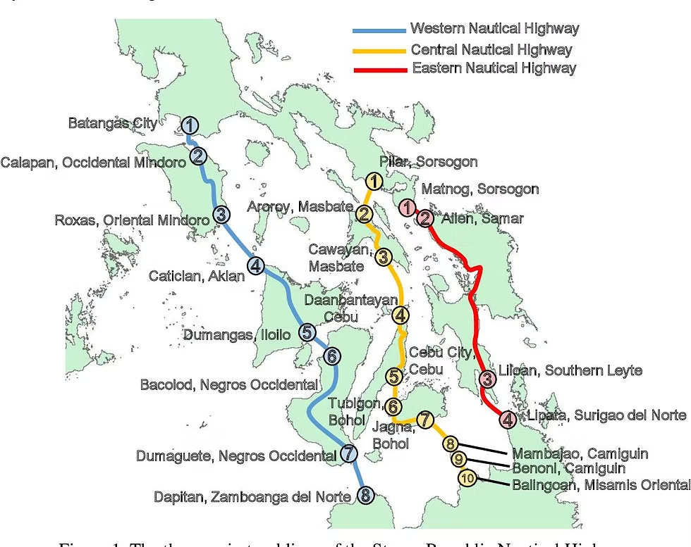
Part of the Strong Republic Nautical Highway, connecting Luzon, Visayas, and Mindanao.
Major Ferry Operators
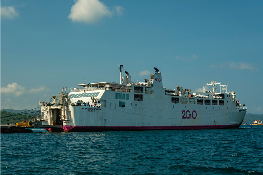
- 2GO Travel — large passenger vessels
- Lite Ferries, OceanJet, FastCat — fast crafts and mid‑size ferries
- Montenegro Lines, Cokaliong — regional routes
Key Inter‑Island Routes
- Cebu ↔ Bohol
- Iloilo ↔ Bacolod
- Luzon ↔ Mindoro ↔ Panay
- Mindanao ↔ Visayas (Cebu, Leyte, Bohol)
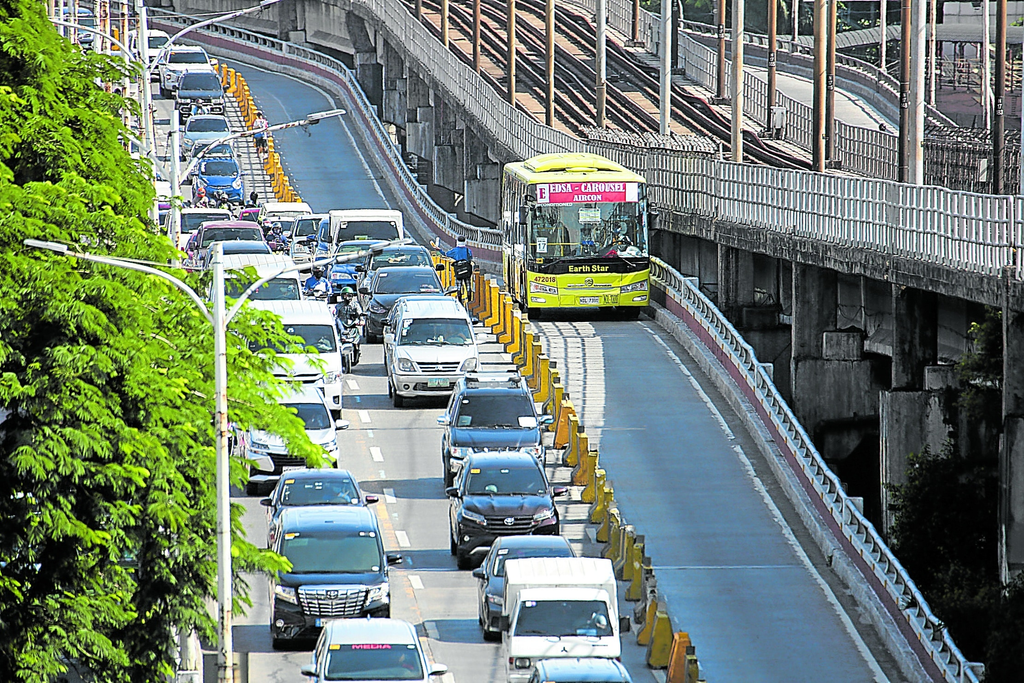
MMDA, DOTr differ on Edsa busway by newsinfo.inquirer.net
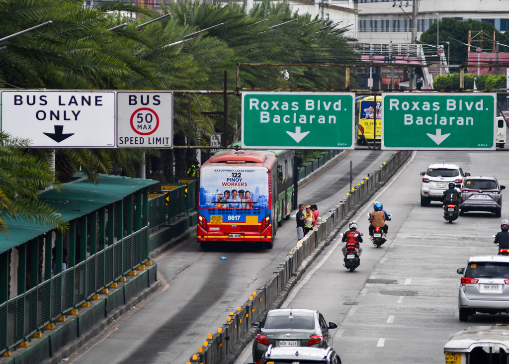
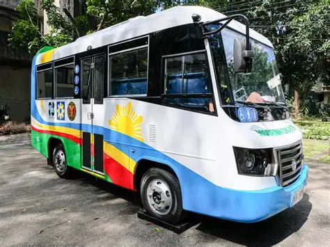
by manilastandard.net DOST touts e-jeep by pco.gov.ph
Bus Systems
Bus networks serve both urban commuters and long‑distance provincial travelers.
Urban Bus Systems
- EDSA Bus Carousel — dedicated busway in Metro Manila
- City buses in Cebu, Davao, Iloilo, Baguio
Provincial Bus Routes
- Victory Liner, Five Star, DLTB, Ceres Liner
- Connect Metro Manila to Luzon provinces and Cebu to Visayas/Mindanao
Modernization Trends
- Contactless payments
- GPS‑enabled fleet tracking
- Electric buses in pilot cities
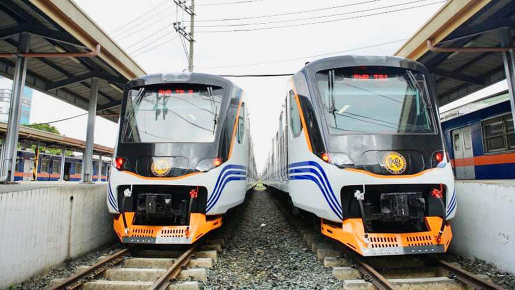
PNR conducts inaugural run by topgear.com.ph
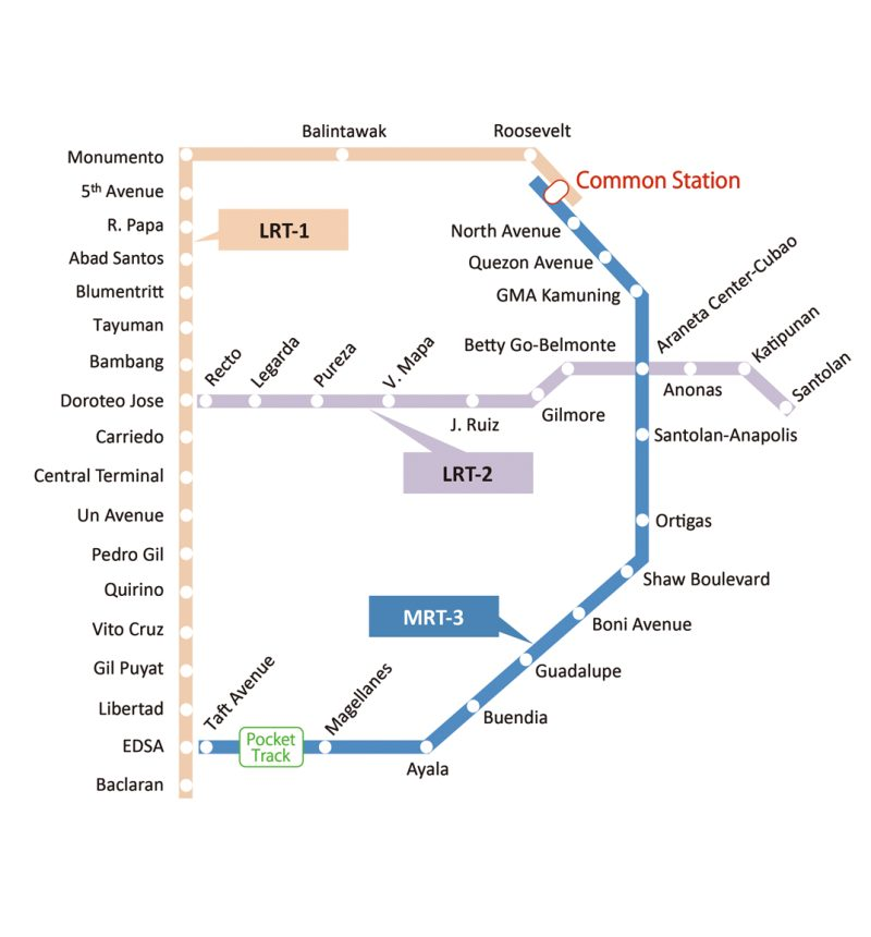
by railprofessional.com
Rail Systems — PNR, LRT, MRT
Rail transport is expanding rapidly, especially in Metro Manila.
PNR (Philippine National Railways)
- Operates commuter rail from Tutuban to Laguna
- Ongoing North–South Commuter Railway (NSCR) expansion
LRT (Light Rail Transit)
- LRT‑1 — Baclaran to Bacoor (extension ongoing)
- LRT‑2 — Recto to Antipolo
MRT (Metro Rail Transit)
- MRT‑3 — EDSA backbone
- MRT‑7 — Quezon City to Bulacan (under construction)
Upcoming Rail Projects
- Metro Manila Subway
- Mindanao Railway Phase 1
- Cebu Monorail proposals
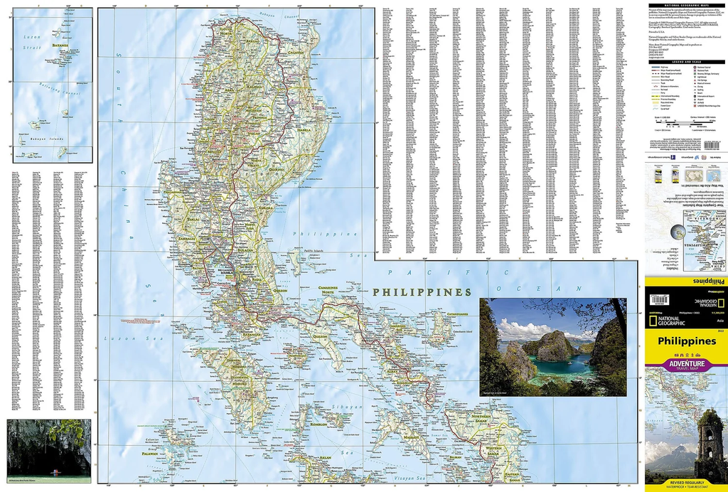
Large Road Map of Philippines by narodnatribuna.info
Road Classifications — National, Secondary, Tertiary
The Department of Public Works and Highways (DPWH) classifies roads into:
National Roads
- Connect major cities, airports, seaports
- Include primary national highways and arterial roads
Secondary Roads
- Link smaller cities, municipalities, and provincial centers
Tertiary Roads
- Local access roads within towns and barangays
H4: Road Infrastructure Challenges
- Congestion in Metro Manila
- Maintenance gaps in rural areas
- Climate‑related damage (typhoons, flooding)
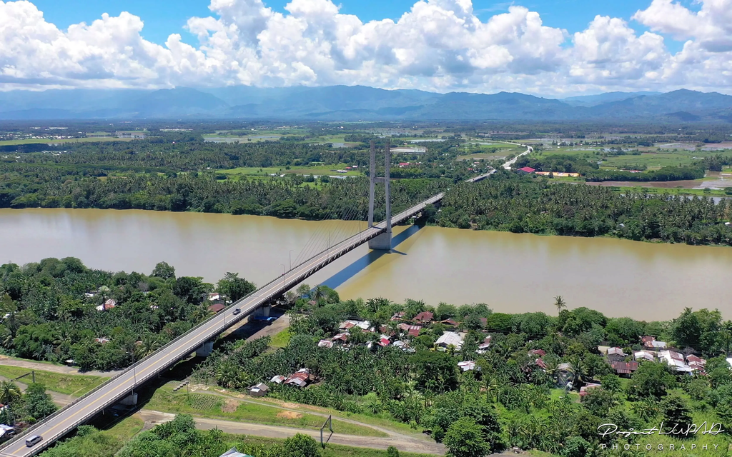
Macapagal Bridge (Longest bridge in Mindanao) by projectlupad.com
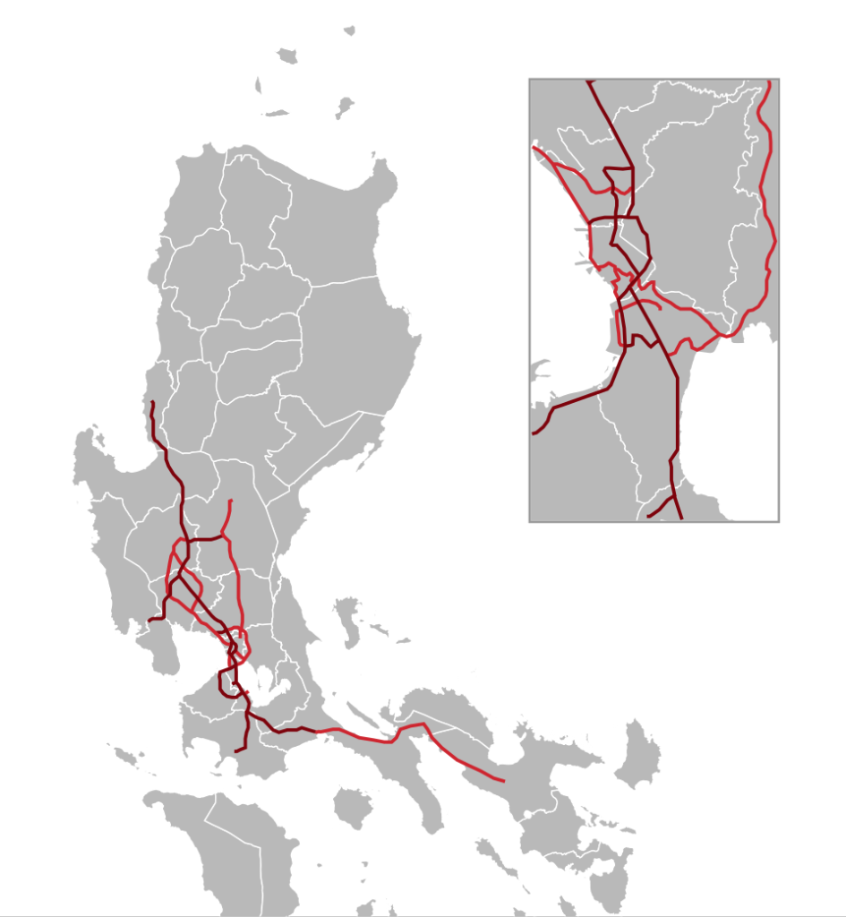
Philippines expressways 2024 by commons.wikimedia.org
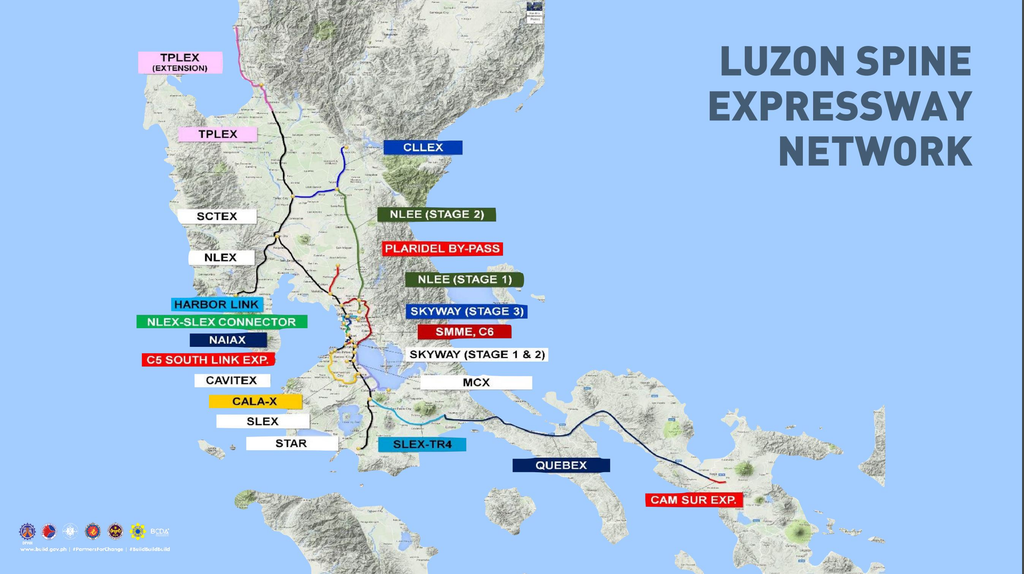
Luzon Spine Expressway Network by morefunwithjuan.com
Bridges & Expressways
Bridges and expressways improve regional connectivity and reduce travel time.
Major Bridges
- San Juanico Bridge — Leyte–Samar
- Mactan–Cebu Bridges — 1st, 2nd, and CCLEX
- Bohol–Panglao Bridge
- Iloilo–Guimaras Bridge (proposed)
- Davao–Samal Bridge (under construction)
Expressways
Primarily in Luzon:
- NLEX — North Luzon Expressway
- SCTEX — Subic–Clark–Tarlac
- TPLEX — Tarlac–Pangasinan–La Union
- SLEX — South Luzon Expressway
- CALAX, CAVITEX, Skyway, MCX
Expressway Expansion Plans
- Luzon Spine Expressway Network
- Visayas and Mindanao expressway feasibility studies
Internal Links
Use this pillar page to link out to your detailed guides:
- Airports Guide
- Seaports Guide
- Ferry Networks
- Bus Systems
- Rail Systems
- Road Classifications
- Bridges & Expressways
Conclusion
The Philippines’ transportation and infrastructure network is the backbone of mobility across its 7,641 islands. Understanding how airports, seaports, ferry routes, bus systems, rail lines, roads, and expressways connect the archipelago gives travelers and researchers a clearer picture of how the country moves — economically, culturally, and geographically.
Whether you’re planning a multi‑city itinerary, studying regional development, or building travel content for your audience, the key takeaway is simple: the Philippines is best explored through a mix of air, sea, and land transport, each offering its own rhythm and experience. Modernization continues across all sectors, from new railways and expressways to upgraded airports and digitalized ferry systems, making travel more efficient year after year.
As you dive deeper into each transport category, you’ll gain a stronger understanding of how infrastructure shapes tourism, accessibility, and regional growth — and how these systems make the Philippines one of the most dynamic travel landscapes in Southeast Asia.