Explore the largest and most important islands of the Philippines, including Luzon, Mindanao, Samar, Negros, Palawan, Panay, Mindoro, Leyte, Cebu, and Bohol. Learn about their size, population, key cities, and geographic significance.
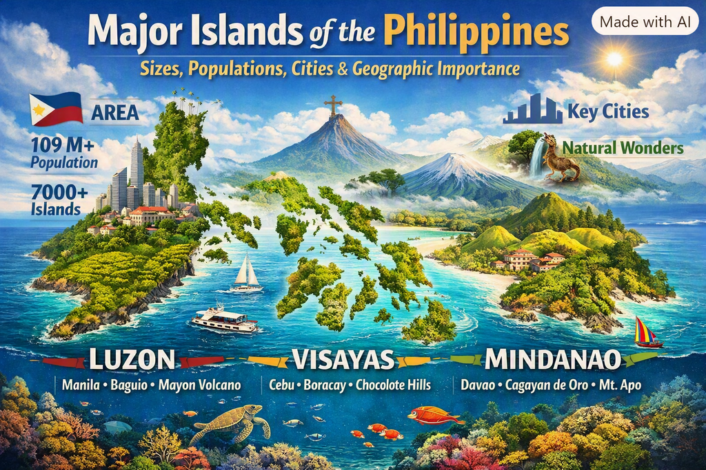
Major Islands of the Philippines: Complete Geographic & Demographic Breakdown
The Philippines is home to over 7,641 islands, but only a handful dominate the country’s geography, economy, culture, and population distribution. This guide provides a comprehensive breakdown of the largest and most significant islands, helping readers understand the landmasses that shape the nation’s identity.
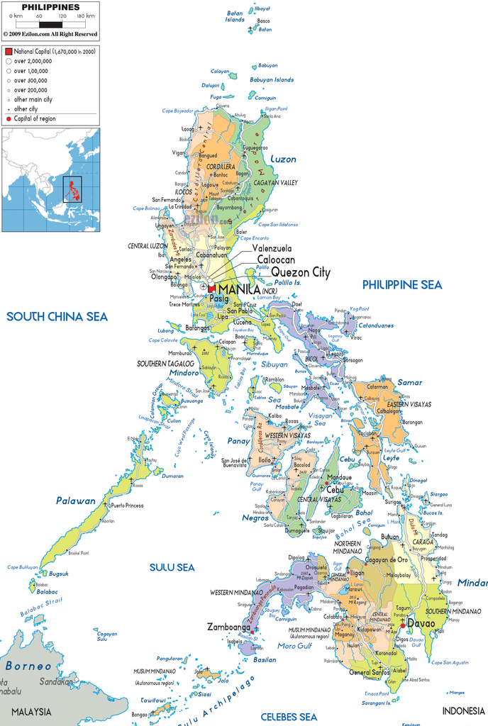
Map by ezilon.com
This page covers:
- Island size (land area)
- Population
- Key cities
- Geographic importance
- Administrative relevance
Use this guide as a foundational reference for deeper exploration of the country’s island groups, regional travel, and eco‑tourism planning.
Luzon Island
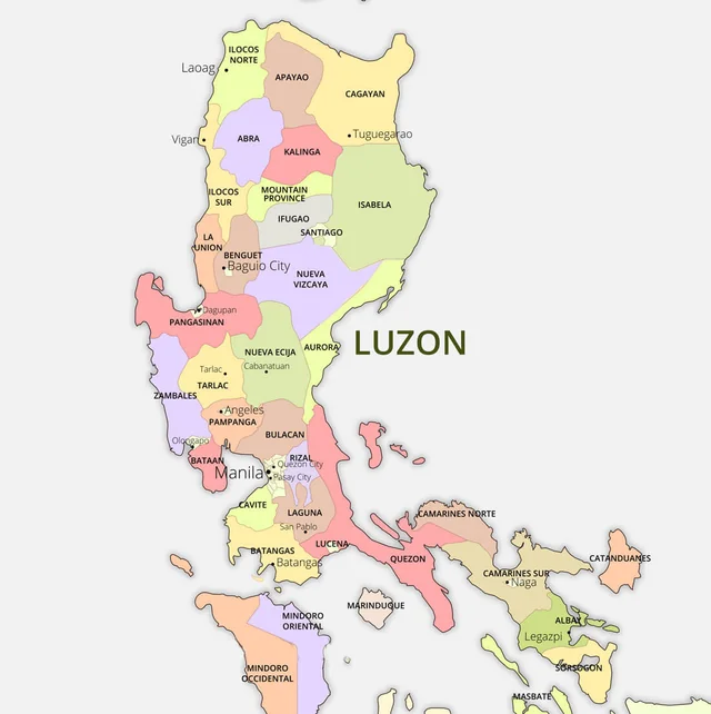
Map by pinnaxis.com
Overview
Luzon is the largest island in the Philippines and the political, economic, and cultural center of the country. It hosts the national capital, Manila, and the majority of major business districts.
Size of the Island
- 109,965 km² (largest island in the Philippines)
Population
- ~65 million (most populous island)
Key Cities
- Manila
- Quezon City
- Makati
- Baguio
- Clark/Angeles
- Naga
Geographic Importance
- Seat of national government
- Largest international gateways (NAIA, Clark)
- Major economic corridors (NCR, CALABARZON, Central Luzon)
- Home to major volcanoes and mountain ranges (Sierra Madre, Cordillera)
Related Guides
- Luzon Island Travel Guide
- Luzon Island Informational Guide
Mindanao Island Group
Overview
Mindanao is the second-largest island and a powerhouse of agriculture, natural resources, and emerging urban centers.
Size of the Island
- 97,530 km²
Population
- ~26 million
Key Cities
- Davao City
- Cagayan de Oro
- Zamboanga City
- General Santos
Geographic Importance
- Major food production hub
- Home to Mt. Apo (highest peak in the Philippines)
- Key ports and trade routes connecting Visayas and Indonesia
Related Guides
- Mindanao Island Travel Guide
- Mindanao Island Informational Guide
Samar

Map by pinterest.ph
Overview
Samar is known for its rugged terrain, caves, rivers, and eco‑tourism potential. It forms the easternmost barrier of the archipelago.
Size
- 13,428 km²
Population
- ~1.9 million
Key Cities
- Catbalogan
- Calbayog
- Borongan (Eastern Samar)
Geographic Importance
- Natural shield against Pacific typhoons
- Home to the Philippines’ largest cave systems
- Key biodiversity and conservation zones
Related Guides
- Samar Island Travel Guide
- Samar island Informational Guide
- Eastern Visayas Travel Guide
Negros
Mao by philippines-life.com
Overview
Divided into Negros Occidental and Negros Oriental, this island is a major agricultural and cultural hub.
Size
- 13,310 km²
Population
- ~4.7 million
Key Cities
- Bacolod
- Dumaguete
- Kabankalan
Geographic Importance
- Sugar industry capital
- Home to Mt. Kanlaon
- Strong tourism and education sectors
Related Guides
- Negros Island Travel Guide
- Negros Island Informational Guide
- Central Visayas Travel Guide
- Western Visayas Travel Guide
Palawan
Map by coeffizienz.de
Overview
Often called the Last Frontier, Palawan is globally recognized for its pristine beaches, limestone cliffs, and protected marine ecosystems.
Size
- 12,189 km²
Population
- ~1.1 million
Key Cities
- Puerto Princesa
- Coron
- El Nido
Geographic Importance
- UNESCO sites (Tubbataha Reefs, Underground River)
- Major eco‑tourism destination
- Biodiversity hotspot
Related Guides
- Palawan Island Travel Guide
- Palawan Island Informational Guide
- MIMAROPA Travel Guide
Panay
Map by rappler.com
Overview
Panay is a cultural and economic center of Western Visayas, home to heritage cities and major ports.
Size
- 12,011 km²
Population
- ~4.4 million
Key Cities
- Iloilo City
- Roxas City
- Kalibo
Geographic Importance
- Gateway to Boracay
- Strong heritage tourism
- Major agricultural and seafood production
Related Guides
- Panay Island Travel Guide
- Panay Island Informational Guide
- Western Visayas Travel Guide
Mindoro
Overview
Mindoro is divided into Oriental and Occidental provinces and is known for beaches, mountains, and indigenous Mangyan communities.
Size
- 10,572 km²
Population
- ~1.4 million
Key Cities
- Calapan
- San Jose
- Mamburao
Geographic Importance
- Home to Mt. Halcon
- Gateway to Puerto Galera
- Important agricultural and fishing zones
Related Guides
- Mindoro Island Travel Guide
- Mindoro Island Informational Guide
- MIMAROPA Travel Guide
Leyte
Map by rochack.com
Overview
Leyte is historically significant and strategically located in Eastern Visayas.
Size
- 7,368 km²
Population
- ~2.5 million
Key Cities
- Tacloban
- Ormoc
Geographic Importance
- Site of the historic Leyte Landing
- Key agricultural and port hub
- Vital link between Visayas islands
Related Guides
- Leyte Island Travel Guide
- Leyte Island Informational Guide
- Eastern Visayas Travel Guide
Cebu
by istanbul-city-guide.com
Overview
Cebu is one of the most economically dynamic islands in the Philippines, with a strong mix of industry, tourism, and culture.
Size
- 4,468 km²
Population
- ~5 million
Key Cities
- Cebu City
- Mandaue
- Lapu-Lapu
Geographic Importance
- Major international airport (MCIA)
- Central Visayas economic hub
- Strong manufacturing and IT-BPM sectors
Related Guides
- Cebu Island Travel Guide
- Cebu Island Informational Guide
- Central Visayas Travel Guide
Bohol
Map by ansvers.com
Overview
Bohol is famous for its unique geological formations, beaches, and wildlife.
Size
- 4,821 km²
Population
- ~1.5 million
Key Cities
- Tagbilaran
- Ubay
- Talibon
Geographic Importance
- Home of the Chocolate Hills
- Tarsier conservation centers
- Strong eco‑tourism and diving destinations
Related Guides
Conclusion – Understanding the Philippines Through Its Major Islands
The Philippines’ largest islands form the backbone of the nation’s geography, culture, and economy. From the political powerhouses of Luzon and Mindanao to the eco‑tourism gems of Palawan and Bohol, each island contributes uniquely to the country’s identity.
This breakdown helps travelers, researchers, and students understand:
- How population and development are distributed
- Where major cities and economic zones are located
- How geography shapes culture and biodiversity
- Why certain islands dominate tourism and industry
For deeper exploration, continue with:
- Island Groups of the Philippines
- Luzon Island Group Travel Guide
- Visayas Island Group Travel Guide
- Mindanao Island Group Travel Guide
- Eco‑Tourism Destinations