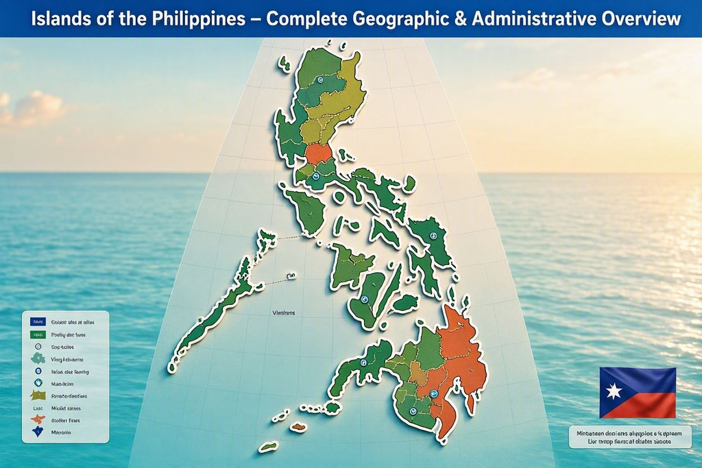
A comprehensive information page detailing the islands of the Philippines, including all major island groups, regional divisions, and administrative classifications such as Luzon, Visayas, Mindanao, and MIMAROPA (with Palawan). Structured for research, reference, and geographic understanding.
Islands of the Philippines: Complete Geographic & Administrative Overview
The Philippines is an archipelagic nation composed of more than 7,641 islands, grouped into three major island clusters: Luzon, Visayas, and Mindanao. These island groups serve as broad geographic categories that help organize the country’s administrative regions, cultural zones, and physical landscapes. Beyond these three clusters, the archipelago includes specialized island-based regions such as MIMAROPA, which contains Mindoro, Marinduque, Romblon, and Palawan.
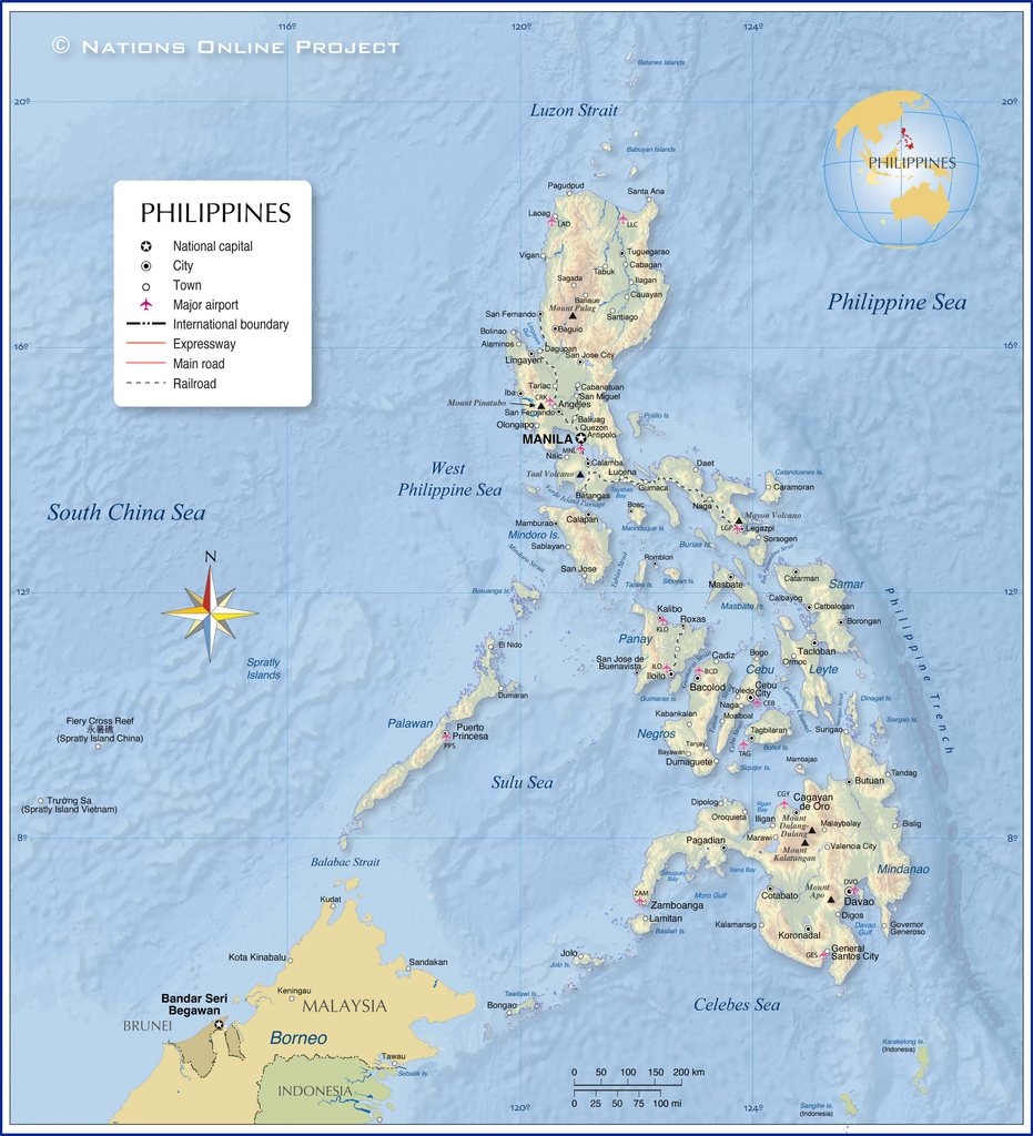
Philippines map by qaqooking.wiki
This page provides a non-tourism, information-focused overview of the islands of the Philippines, their classifications, and how they relate to the country’s administrative structure. It is designed as a reference resource for researchers, students, and readers seeking a clear understanding of the archipelago’s geographic organization.
Major Island Groups of the Philippines
The three primary island groups—Luzon, Visayas, and Mindanao—are not political units but geographic groupings that help categorize the country’s islands and regions. Each group contains multiple administrative regions and provinces, each with its own distinct landforms, population centers, and cultural identities.
Luzon Island Group
The Luzon Island Group is the largest and most populous of the three major island clusters. It includes the main island of Luzon, several surrounding island provinces, and the island-based region of MIMAROPA. Luzon is the country’s political and economic center, hosting the National Capital Region (NCR) and numerous administrative regions.
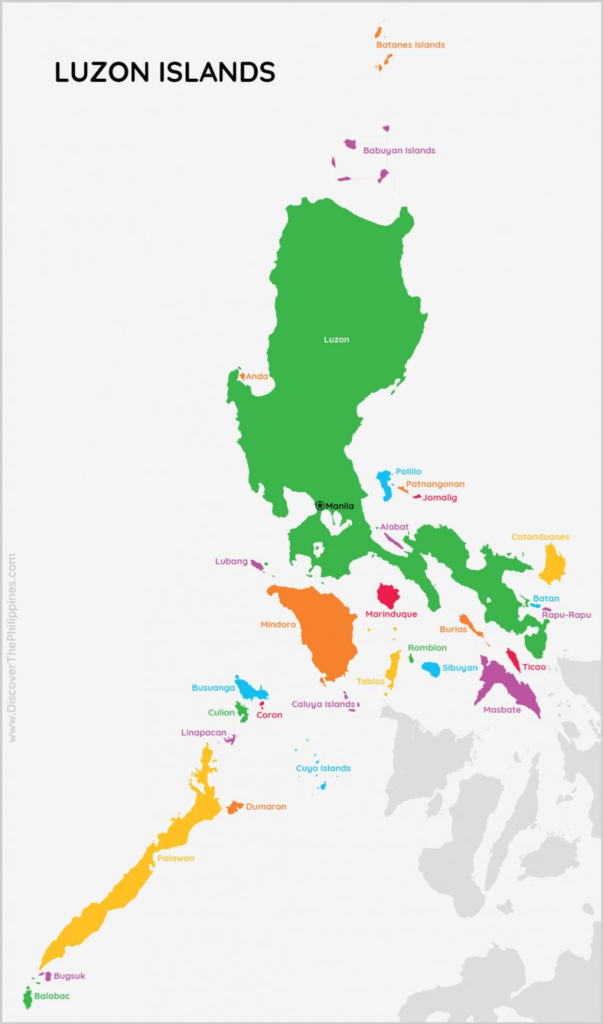
Luzon Island Group map by bgeec.visulexi.de
Geographic Composition of the Luzon Island Group
The Luzon Island Group includes the following major islands and island provinces:
- Luzon Island – The largest island in the Philippines, containing multiple regions and the national capital.
- Mindoro Island – Divided into Oriental and Occidental Mindoro.
- Marinduque Island – A heart-shaped island province south of Luzon.
- Romblon Island – An island province composed of multiple islands including Tablas and Sibuyan.
- Palawan Island – A long, narrow island forming the western boundary of the archipelago.
Administrative Regions Within the Luzon Island Group
Luzon contains several administrative regions, each composed of multiple provinces and islands:
- Ilocos Region (Region I)
- Cagayan Valley (Region II)
- Cordillera Administrative Region (CAR)
- Central Luzon (Region III)
- CALABARZON (Region IV‑A)
- MIMAROPA (Region IV‑B)
- National Capital Region (NCR)
- Bicol Region (Region V)
MIMAROPA Region (Region IV‑B)
MIMAROPA is a unique island-based region within the Luzon Island Group. Its name is an acronym representing its provinces:
- Mindoro (Oriental & Occidental)
- Marinduque
- Romblon
- Palawan
This region is geographically separated from mainland Luzon and consists entirely of islands, making it a distinct administrative cluster within the Luzon Island Group.
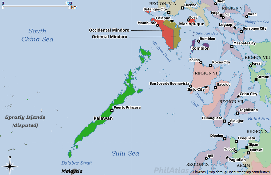
MIMAROPA Region (Region IV‑B) map by storage.googleapis.com
Visayas Island Group

Visayas Island Group Map by ar.inspiredpencil.com
The Visayas Island Group occupies the central portion of the Philippine archipelago. It is composed of several mid-sized islands and numerous smaller ones, forming a dense cluster of landmasses surrounded by interconnected seas. The Visayas is divided into three administrative regions: Western Visayas, Central Visayas, and Eastern Visayas.
Major Islands of the Visayas
The Visayas contain several of the country’s most historically significant and densely populated islands:
- Panay Island
- Negros Island
- Cebu Island
- Bohol Island
- Leyte Island
- Samar Island
- Guimaras Island
- Siquijor Island
Administrative Regions of the Visayas
The Visayas Island Group includes:
- Western Visayas (Region VI)
- Central Visayas (Region VII)
- Eastern Visayas (Region VIII)
Island Distribution and Characteristics
The Visayas are characterized by:
- Interconnected island chains
- Maritime cultural zones
- Shared historical and linguistic influences
- Distinct administrative divisions despite geographic proximity
Mindanao Island Group
The Mindanao Island Group occupies the southern portion of the Philippines and includes the country’s second-largest island, Mindanao, along with several surrounding island provinces. It is known for its diverse cultural composition, autonomous administrative zones, and wide geographic range.
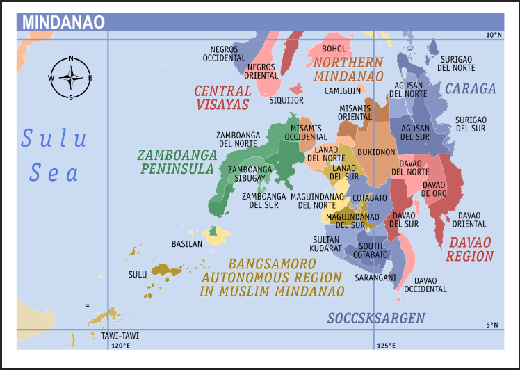
Mindanao Island Group Map By fity.club
Major Islands of the Mindanao Group
The Mindanao Island Group includes:
- Mindanao Island – The second-largest island in the Philippines.
- Siargao Island
- Camiguin Island
- Dinagat Island
- Basilan Island
- Jolo Island -Sulu province’s main island
- Tawi-Tawi Island
Administrative Regions of the Mindanao Island Group
Mindanao contains several administrative regions:
- Zamboanga Peninsula (Region IX)
- Northern Mindanao (Region X)
- Davao Region (Region XI)
- SOCCSKSARGEN (Region XII)
- Caraga (Region XIII)
- Bangsamoro Autonomous Region in Muslim Mindanao (BARMM)
Island Chains of the Sulu Archipelago
The Sulu Archipelago forms a distinct island chain within the Mindanao Island Group, consisting of:
- Jolo
- Siasi
- Bongao
- Simunul
- Sitangkai
These islands form a maritime corridor between Mindanao and Borneo.
Island Classification in the Philippines
The Philippines classifies its islands based on several criteria:
By Size
- Large islands – Luzon, Mindanao, Negros, Samar, Palawan
- Medium islands – Cebu, Bohol, Leyte, Panay
- Small islands – Thousands of minor islands and islets across all regions
By Administrative Region
Each island belongs to one of the country’s 17 administrative regions, which are grouped into the three major island clusters.
By Province
Provinces serve as the primary local government units, each containing one or more islands.
By Cultural and Linguistic Zones
Island groups often align with linguistic regions such as:
- Ilocano
- Tagalog
- Bikolano
- Visayan languages
- Mindanao languages
Importance of Island Grouping in National Planning
Island grouping supports:
Geographic Organization
It simplifies the classification of thousands of islands into manageable clusters.
Administrative Coordination
Regions within each island group share geographic proximity, aiding governance.
Infrastructure Planning
Island grouping helps organize transportation networks, maritime routes, and regional development.
Statistical Reporting
Government agencies use island groups for census, economic data, and geographic analysis.
Summary of the Philippine Island Structure
The Philippines’ island system is organized into:
Three Major Island Groups
- Luzon
- Visayas
- Mindanao
Seventeen Administrative Regions
Each region contains multiple provinces and islands.
Its 7,641 Islands
Ranging from large landmasses to small uninhabited islets.
Related Guides and Reference Pages
- Philippine Regions Overview
- Luzon Regional Guides
- Visayas Regional Guides
- Mindanao Regional Guides
- MIMAROPA Region
- Island Provinces of the Philippines
Final Thoughts for Statistics Lovers
For anyone who finds beauty in numbers, patterns, and the quiet logic beneath complex systems, the islands of the Philippines offer a surprisingly rich playground. An archipelago of 7,641 islands is, at its core, a living dataset—one shaped by geography, history, administrative evolution, and human settlement. Each island group, each region, each province represents a variable in a vast national equation.
If you enjoy exploring distribution, classification, regional clustering, or hierarchical structures, the Philippine archipelago is a model worth diving into. Its three major island groups form natural top-level categories; its 17 administrative regions create mid-level segmentation; and its thousands of islands provide granular detail that rewards deeper analysis. Whether your interest lies in population density, land area comparisons, linguistic distribution, or administrative boundaries, the Philippines offers a dataset that is both intricate and endlessly fascinating.
For statistics lovers, the real joy comes from recognizing that behind every number is a story—an island shaped by time, a region defined by geography, and a nation connected by patterns waiting to be explored.