Explore the Islands of the Philippines through a complete geographic, administrative, and tourism-focused overview. Learn about major islands, island groups, clusters, land area, divisions, and top surfing & resort destinations.
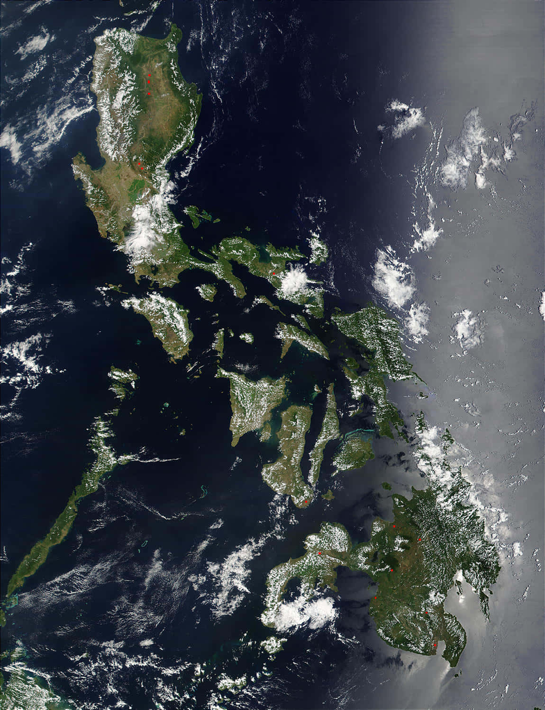
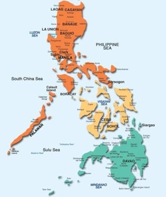
Map by wallpapers.com and philnews.ph
Islands of the Philippines – National Geographic & Tourism Overview
A complete national overview of the Islands of the Philippines, covering geography, administrative context, major island groups, and top tourism highlights. This page introduces the archipelago’s structure, land area, cultural regions, and the country’s most notable surfing and resort destinations.
This page links directly to your core informational island pages:
- Islands of the Philippines – National Overview (Geography, Administration & Tourism)
- Major Islands
- Island Groups
- Number of Islands
- Island Clusters
- Administrative Divisions
- Land Area & Geography
And connects to tourism guides such as:
- Top Surfing & Resort Guides
- Destinations by Island Groups
- Best Islands to Visit
Understanding the Philippine Archipelago
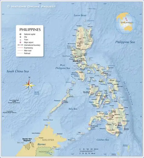
by ar.inspiredpencil.com
The Philippines is one of the world’s largest archipelagos, stretching across the western Pacific Ocean. Its islands vary dramatically—from massive landmasses like Luzon and Mindanao to tiny coral islets and sandbars.
The archipelago’s complexity is best understood through its major islands, island groups, clusters, and administrative divisions, each of which plays a role in national identity, governance, and tourism.
Major Islands of the Philippines
The Philippines’ major islands form the backbone of its geography and population distribution. These islands are covered in detail in your Major Islands page.
Luzon
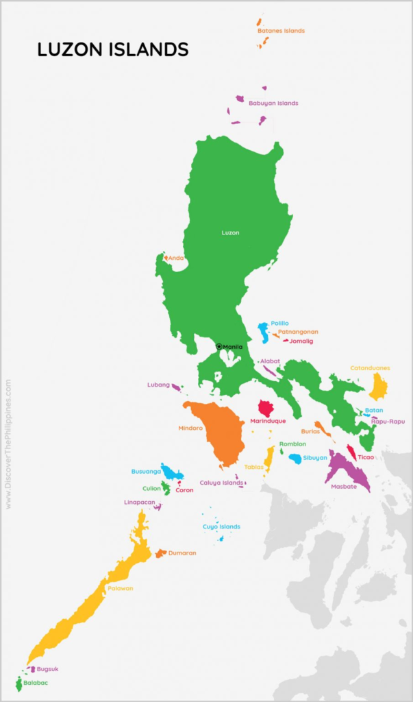
Luzon is the largest island, home to the capital Manila, major economic centers, and diverse landscapes ranging from the Cordillera mountains to coastal plains.
Mindanao
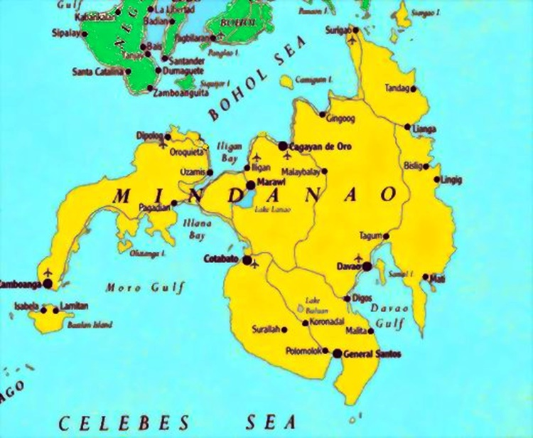
Mindanao is the second-largest island, known for its rich cultural diversity, fertile agricultural lands, and growing tourism destinations like Siargao and Davao.
Visayas Islands
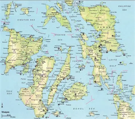
The Visayas consist of several major islands including Cebu, Negros, Panay, Leyte, Bohol, and Samar, forming the cultural and geographic heart of the central Philippines.
These major islands anchor the country’s administrative regions, transportation networks, and tourism flows.
Island Groups of the Philippines

Map by mumble.nationalgeographic.com
The Philippines is traditionally divided into three primary island groups, which you explore in detail on your Island Groups page.
Luzon Island Group
Includes Metro Manila, Northern Luzon, Central Luzon, and Southern Tagalog, and Southwestern Tagalog regions It is the political and economic center of the country.
Visayas Island Group
Includes Western Visayas, Central Visayas, and Eastern Visayas regions. Known for its beaches, cultural festivals, and historical sites. The Visayas are a major tourism hub.
Mindanao Island Group
Made up of mostly the main island of Mindanao, the Sulu Archipelago, and other islands. A vast region with strong cultural heritage, natural wonders, and emerging tourism destinations.
These island groups help organize the country’s geography and administrative structure.
Number of Islands in the Philippines
by storage.googleapis.com
The Philippines is officially recognized as having over 7,600 islands, though the exact number varies depending on tidal conditions, geological changes, and updated surveys.
The Number of Islands page provides a detailed breakdown of:
- Official counts from government agencies
- How islands are classified
- Differences between inhabited and uninhabited islands
- Seasonal and tidal island changes
This information is essential for geographic accuracy and educational content.
Island Clusters of the Philippines
Island clusters are smaller groupings within the major island groups. These clusters often share cultural, geographic, or ecological characteristics.
The Island Clusters page explains clusters such as:
Batanes & Babuyan Islands
Northernmost islands with distinct Ivatan culture and dramatic landscapes.
Calamianes, Cuyo & Palawan Clusters
Part of the MIMAROPA region, known for world-class marine biodiversity.
Visayan Sea Clusters
Includes island groups around Cebu, Iloilo, and Negros.
Sulu Archipelago
A chain of islands with rich cultural heritage and unique ecosystems.
These clusters help define regional identity and tourism patterns.
Administrative Divisions of the Philippine Islands
Map by wikipedia.com
The Philippines’ islands are organized into regions, provinces, cities, municipalities, and barangays. Your Administrative Divisions page provides a complete breakdown.
Regions
The country has 17 administrative regions, including:
- NCR (National Capital Region)
- Ilocos Region
- Cordillera Administrative Region
- MIMAROPA
- BARMM (Bangsamoro Autonomous Region in Muslim Mindanao)
Provinces
There are 83 provinces, each with unique geographic and cultural identities.
Cities & Municipalities
Urban centers and rural towns are distributed across the islands, forming local governance units.
Barangays
The smallest administrative unit, essential for local community management.
Understanding these divisions is crucial for geographic literacy and travel planning.
Land Area & Geography of the Philippine Islands
The Philippines’ land area is approximately 300,000 square kilometers, with diverse geographic features:
Mountain Ranges
Including the Cordilleras, Sierra Madre, and Bukidnon ranges.
Volcanoes
Such as Mayon, Taal, Kanlaon, and Mount Apo.
Coastal Systems
The country has one of the world’s longest coastlines, supporting marine biodiversity and tourism.
River Basins & Lakes
Major water systems include the Cagayan River, Agusan River, Laguna de Bay, and Lake Lanao.
Your Land Area & Geography page expands on these features with maps, data, and regional comparisons.
Top Surfing & Resort Guides
The Philippines is a global hotspot for surfing, beach tourism, and island resorts. Your Top Surfing & Resort Guides page highlights premier destinations such as:
Siargao (Caraga)
The “Surfing Capital of the Philippines,” home to Cloud 9.
H3 La Union province (Luzon)
A popular surf town with a vibrant coastal culture.
Baler (Aurora)
Historic surf destination with consistent waves.
H3: Pagudpud (Ilocos Norte)
Known for white-sand beaches and scenic coastlines.
Boracay (Western Visayas)
World-famous island with luxury resorts and water activities.
These guides help travelers plan trips based on surfing seasons, resort types, and regional accessibility.
Related Guide: Best Surfing & Resort Towns in the Philippines
Conclusion
The Philippines’ islands form a complex and beautiful archipelago defined by geography, culture, biodiversity, and tourism. This landing page serves as your central hub, connecting all major informational and tourism-focused island content on TuristasAPilipinas.com.
Use the guided links throughout this page to explore deeper:
- Major Islands
- Island Groups
- Number of Islands
- Island Clusters
- Administrative Divisions
- Land Area & Geography
- Top Surfing & Resort Guides